Trail Walking La Rochegiron - Le Moulin - La Blanchère - Font Martine - Vière - Photo

Le Moulin - La Blanchère - Font Martine - Vière

 dsurin
dsurin

User

© OpenStreetMap contributors
Length
Length
11.1 km
Max alt
Max alt
1126 m
Uphill gradient
Uphill gradient
279 m
Km-Effort
Km-Effort  
14.8 km
Min alt
Min alt
853 m
Downhill gradient
Downhill gradient
279 m
Boucle
Boucle
Yes
Creation date :
2021-08-25 08:29:52.0
Updated on :
2021-08-25 14:01:40.046

(0 Reviews)

Walking
Walking
2h53
Difficulty : Medium

Scan this QR Code to open this trail in the SityTrail application

FREE GPS app for hiking

Logo SityTrail SityTrail

IGN / Geographical institutes

Download SityTrail from the App Store Download SityTrail from Google Play

Logo SityTrail SityTrail World

The world is yours!

Download SityTrail from the App Store Download SityTrail from Google Play Download SityTrail on Huawei AppGallery

About

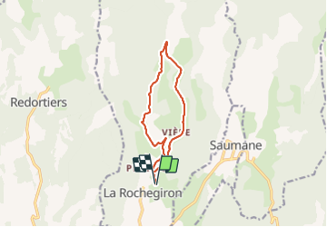
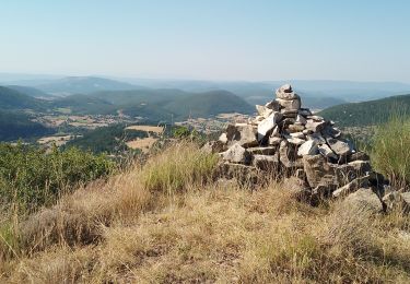
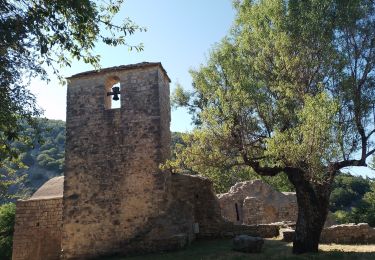
Trail Walking of 11.1 km to be discovered at Provence-Alpes-Côte d'Azur, Alpes-de-Haute-Provence, La Rochegiron. This trail is proposed by dsurin.

Description

Départ depuis le gîte Le Moulin (j'y séjourne, mais vous pouvez partir du hameau du Joncquet).
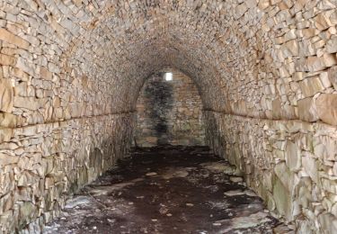
Monter par la route forestière de La Roche, puis prendre le chemin de La Blanchère.
Redescendre par le chemin menant à la Font Martine.
Revenir par le chemin de Vière.

Elevation profile

Positioning

Country:
France
Region :
Provence-Alpes-Côte d'Azur
Department/Province :
Alpes-de-Haute-Provence
Municipality :
La Rochegiron
Location:
Unknown
Start:(UTM)
713074 ; 4884099 (31T) N.

Trails nearby

Trail Walking Redortiers - Le Contadour - Banon - Photo
Walking
tracegps

Walking

Medium
(1)
Redortiers, Provence-Alpes-Côte d'Azur, Alpes-de-Haute-Provence, France
9.6 km | 12.7 km-effort
2h 10min
Yes
Trail Walking La Rochegiron - larochegiron.fon martine - Photo
Walking
Roger

Walking

Medium
La Rochegiron, Provence-Alpes-Côte d'Azur, Alpes-de-Haute-Provence, France
8.7 km | 12.6 km-effort
3h 51min
Yes
Trail Walking L'Hospitalet - les bergeries de saumane.  1 - Photo
Walking
Roger

Walking

Difficult
L'Hospitalet, Provence-Alpes-Côte d'Azur, Alpes-de-Haute-Provence, France
11.7 km | 16.8 km-effort
4h 27min
Yes
Trail Walking L'Hospitalet - saumane . les girons,  clos guilhen,  foureynard,  la tour  - Photo
Walking
Roger

Walking

Medium
L'Hospitalet, Provence-Alpes-Côte d'Azur, Alpes-de-Haute-Provence, France
10.4 km | 14.8 km-effort
3h 54min
Yes
Trail Walking La Rochegiron - la rochegiron 04.fon Martine, la blanchere, veire - Photo
Walking
Roger

Walking

Medium
La Rochegiron, Provence-Alpes-Côte d'Azur, Alpes-de-Haute-Provence, France
8.7 km | 12.4 km-effort
2h 52min
Yes
Trail Walking Ongles - Le rocher d ongles. lardiers par le collet de champon  - Photo
Walking
Roger

Walking

Medium
Ongles, Provence-Alpes-Côte d'Azur, Alpes-de-Haute-Provence, France
7.8 km | 10.3 km-effort
2h 36min
Yes
Trail Walking L'Hospitalet - l hospitalet. les anglais.la plus haute grange.la bergerie sans nom  - Photo
Walking
Roger

Walking

Easy
L'Hospitalet, Provence-Alpes-Côte d'Azur, Alpes-de-Haute-Provence, France
5.6 km | 8.4 km-effort
2h 6min
Yes
Trail Walking Saumane - saumane.le chant de l amant - Photo
Walking
Roger

Walking

Easy
Saumane, Provence-Alpes-Côte d'Azur, Alpes-de-Haute-Provence, France
6.4 km | 8.8 km-effort
2h 25min
Yes
Trail Walking La Rochegiron - la rochegiron. vievre. la blanchete - Photo
Walking
Roger

Walking

Medium
La Rochegiron, Provence-Alpes-Côte d'Azur, Alpes-de-Haute-Provence, France
10.1 km | 14.3 km-effort
3h 44min
Yes


Close
My subscriptions